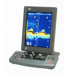
Description
Features
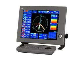
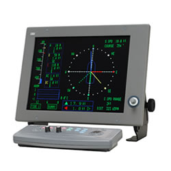
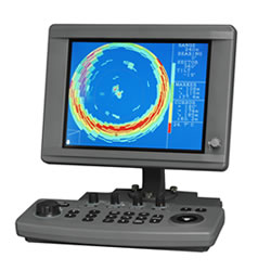
The new JLN-652 Doppler current meter integrates acompelling combination of function and features, packedinto a compact space-saving design, enabling quick andaccurate acquisition of speed and tidal current data.
3D twist mode

You can view the current direction and speed in real time with the twist mode. With this advanced feature, an operator is able to assess current speed and direction, enhancing the timing on when to deploy the nets in the water. Naturally, the twist display mode is accompanied with a wide range of information, such as current speed range, depth range, temperature history from external sensor and more.
Up and down current

JRC engineers listened closely to feedback given by captains and realized yet another unique function in this class of current meters. The JLN-652 is able to accurately measure up and down current, particularly useful to predict the sinking ratio of your nets by following the natural motion of the underwater current.
50 independent measuring layers at deep current
The JLN-652 Doppler current meter has the ability to process and display continuous tidal currents of 50 independent measuring layers down to maximum 200 meter depending on sea condition. To simplify matters, the user only has to set five depths layers (A, B, C, D, E), of which each layer is measured in four directions. The 50 layers are automatically set relative to depth which has been indicated. The user can select the depth of each layer, showing different information. You can also select bearing1 displayed as North-up (with true north at the top of the display) and Head-up (with bow at the top of the display).
Automatic speed relative to bottom
TNormally run automatically, the new JLN-652 allows bottom tracking with depths up to approximately 2502 meters, measuring direction and speed relative to the sea bottom. If sea bottom becomes too deep, it automatically switches to water tracking mode or through GPS mode, depending on user selection.
Bottom current tracking
The bottom current layer (E) has the ability to automatically shift and display the current close to bottom following the contours of the sea bottom. This is of great help for the operator when fishing in areas with frequently variable depth.

